The Coupeville Lions Club will unveil a new map on the old Highway 525 pull out north of Greenbank.
The ribbon cutting ceremony will be held at 3 p.m. Saturday, April 6. Community members who wish to participate can follow the brown heritage highway signs on the old highway 525 pull out to arrive at their destination.
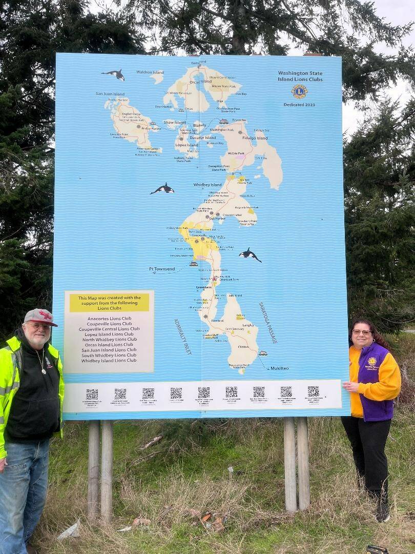
The old map, which was the Coupeville Lions’ project several decades ago and was placed there well before the trees grew up and around it, overlooked the view of the Lake Hancock estuary and the fields of the Greenback Farm.
Over time, the map had become so worn out by Western Washington’s wet weather that it began to crumble, requiring some restoration work. The new map was created by Map Artist Kay Parsons and by Humphrey Signs — who also installed the map.
Lions Zone Chair Carolyn O’Dell also suggested including Whidbey Island, Fidalgo Island, San Juan Island, Orcas Island, and Lopez Island on the map, which also shows tourist destinations and Lions logos on the where all the Lions Clubs are located.
The Coupeville Lions Club provided the brunt of the financial resources, but each of the contributing Lions Clubs provided generous donations along with individual donations to bring this map to life.
For more information about the Coupeville Lions Club, visit coupevillelions.org.