Whidbey’s geological hazard zones have landslide potential
Published 1:30 am Friday, July 15, 2022
Residents should be aware, but not worried, about the potential for landslides on Whidbey Island.
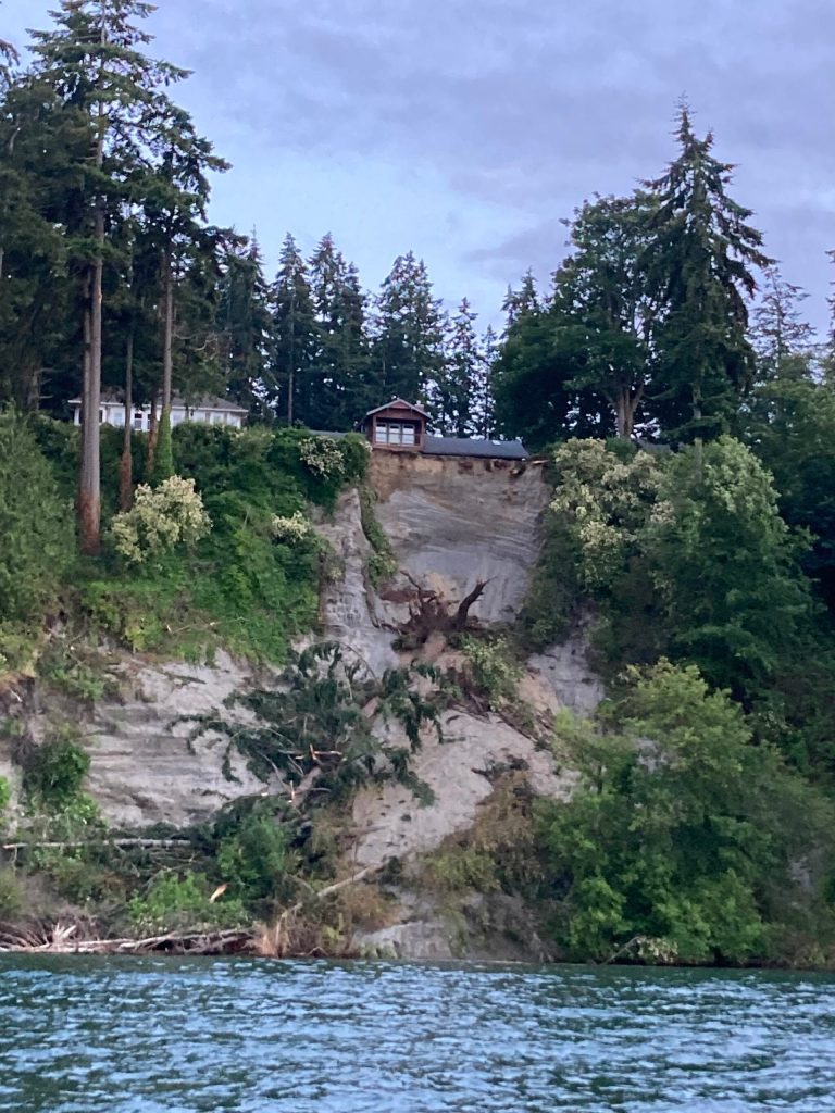
A landslide occurred in Langley on June 18 about 40 yards away from a waterfront home near Noblecliff Place. At least three large trees fell down a 100 foot cliff to the beach below. Fortunately, no property was damaged nor persons injured as a result.
The landslide happened in a geologically hazardous area, which the state requires counties to regulate.
Whidbey Island has several geologically hazardous areas, including steep bluffs near shorelines, and slopes that have a 21.8 degree angle or greater.
Geotechnical engineer Scott Palmer, owner of Palmer Geotechnical Consultant, Inc. in Coupeville, is an expert in building on soil in these areas.
“Anytime you want to build with or on soil, hopefully you will use a geotechnical engineer if there’s any unusual aspects of the project,” he said.
Palmer said the cause of the Langley landslide was simply due to geology. Water, gravity and vegetation, or the lack thereof, all played a part.
Luckily, there are things people can do to lower the risk of landslides.
“The first thing is monitor,” Palmer said.
Homeowners should be on the lookout for warning signs of landslides, such as unexpected plant growth, cracks in soil, or trees that are shifting position.
Planting native vegetation with root structures that retain soil and control water runoff can prevent landslides.
“They help the hill defy gravity, if you will,” Palmer said.
Homeowners can also control water by putting in a storm water pipe that “takes your roof downspouts away from the slope, or if it has to go toward the slope, then it goes all the way down to the beach,” he said.
Lastly, homeowners can build retaining walls, but that can be a more expensive option.
To find out where the geographically hazardous areas of Whidbey Island are, people can go to Island County’s website and view a map of critical areas using the unstable and steep slope layers.
The map is located at icgeomap.islandcountywa.gov/Html5Viewer/Index.html?viewer=ICGeoMap.
Palmer cautioned that even if an area of land is considered hazardous, it does not necessarily mean a landslide will occur there.
If people are concerned about the risk of a potential landslide, they should contact the county or the city where they live for a list of geotechnical consultants who deal with landslides.