A new app launched by the American Red Cross is custom made for people who live in or visit earthquake prone areas.
The free Earthquake App is the third in a series created by the Red Cross, coming on the heels of the organization’s First Aid and Hurricane apps, which have been downloaded more than one million times.
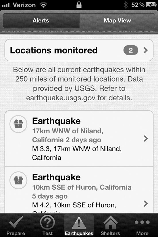
The app is for use on both iPhone and Android smartphone and tablet platforms and is available in both English and Spanish.
“This newest app gives instant access to local and real time information on what to do before, during and after earthquakes,” said Red Cross Regional Director Chuck Morrison. “People will receive earthquake notifications and can monitor activity where other family and friends reside.”
“More and more people are using social media,” said Nancy Waddell, Co-Leader, South Whidbey Islands Chapter Red Cross Response Team. “It’s an attempt to reach those users who are using these devices to get information.”
Planning for the island’s ‘what if’ scenario
Waddell said the launch of the new app coincided with National Preparedness Month (September).
“These apps really help with planning because it gives people the tools they need to keep handy right on their smartphone,” she said.
The app features real-time alerts and Shake Zone Impact Maps, simplifying earthquake data for users.
Other features include: notifications showing the epicenter, magnitude and intensity; one-touch messaging that allows users to broadcast an “I’m safe” message; locations of Red Cross shelters; checklists and simple steps to create a family emergency plan; information on events that may happen after an earthquake, such as fires and tsunamis; and a toolkit with flashlight, strobe light and an audible alarm.
“It’s another communication tool to help people be prepared and be able to access their plans,” Waddell said. “Who can find a little piece of paper with notes? For people with smartphones, everybody has them with them.”
“A disaster, when it happens, can hit small or it can hit large,” said Islands Red Cross Community Chapter Executive Director Mary Frances Close. “We’re trying to get people to think about the ‘what if’ scenario and have a plan in place.”
Waddell said many people on Whidbey Island often ask where the Red Cross shelters are located, or which shelter would be open in the event of an emergency. There’s not a good answer to that, Waddell said, because they won’t know until something happens. The new app provides a link to the national shelter system.
“That is really valuable,” she said. “Because we’re not clear which shelter would be open until an event happens. We rely on the national shelter system.”
In 2011, the Islands Chapter of the Red Cross helped 28 families affected by house fires and other emergencies and provided emergency communications and other assistance for more than 800 military families through Red Cross’ Service to Armed Forces Program. Volunteers provide service in the San Juans, Fidalgo and Whidbey Island. Go to www.redcross.org for information.