New tsunami sirens installed on North, Central Whidbey
Published 1:30 am Tuesday, August 17, 2021
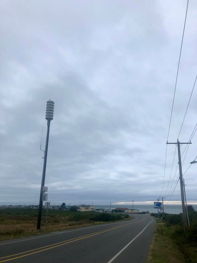


There are five new tsunami warning sirens on North and Central Whidbey Island to alert residents of an impending threat.
The new All-Hazard Alert Broadcast sirens are located at Dugualla Bay, Oak Harbor Marina, West Beach Road, Driftwood County Park and Lagoon Point, according to a statement from the Washington Military Department.
The new sirens are part of the chain of 122 sirens along Washington’s coast. The sirens are meant to alert people who may not have radio, television or smartphones about incoming threats, but are not meant to be heard indoors. State officials advised that residents have radios tuned to the National Oceanic and Atmospheric Association alerts inside their homes to hear warnings.
In the event of a tsunami threat, people will hear a wailing sound similar to what people may hear in a sci-fi movie if they are within about a mile of the siren. After the wail, a voice in both English and Spanish will tell people to seek high ground immediately.
Unless there is a tsunami threat, residents will only hear the wail once per year during the third Thursday in October. A voice will explain that it is just a test and the event will be around the same time as the Great Washington ShakeOut to bring awareness to earthquake and tsunami safety.
People will also hear routine testing at noon on the first Monday of each month. The sirens will play the Westminster Chimes.
The sirens should be helpful for tsunami events from earthquakes in places as far away as Alaska, Japan and Southeast Asia, according to the Washington Military Department.
A tsunami could also happen as a result of an earthquake on the South Whidbey or Seattle faults and give Whidbey Island residents a short window of time to reach higher ground.
A tsunami generated by the “Big One,” or a 9.0 magnitude quake along the Cascadia subduction zone, could reach the west side of Whidbey via the Strait of Juan de Fuca in approximately one hour and 30 minutes, according to an April 2021 study by the Washington Department of Emergency Management. Large waves could reach more than 16 feet and travel north into the Strait of Georgia and south through Puget Sound. The beach at Fort Ebey State Park would be hit first.
In one of the study’s scenarios, Deception Pass State Park could be inundated with up to 11.7 feet of water at maximum after the mega-quake. On the opposite side of the island, Oak Harbor could be inundated with up to 6.7 feet of water after the quake.
“This life-saving project brought together state agencies, tribal, county and city emergency management as well as other important stakeholders to ensure Washington’s coastal communities can be alerted in the event of a tsunami warning,” said Maximilian Dixon, the geologic hazards supervisor for the state Emergency Management Division.