County study calls for speed limit changes
Published 1:30 am Tuesday, March 14, 2023


Speed limits on roads throughout rural Island County may change if commissioners adopt recommendations from a speed limit study.
Commissioners are scheduled to discuss draft recommendations for speed limits on North Whidbey during a workshop meeting Wednesday.
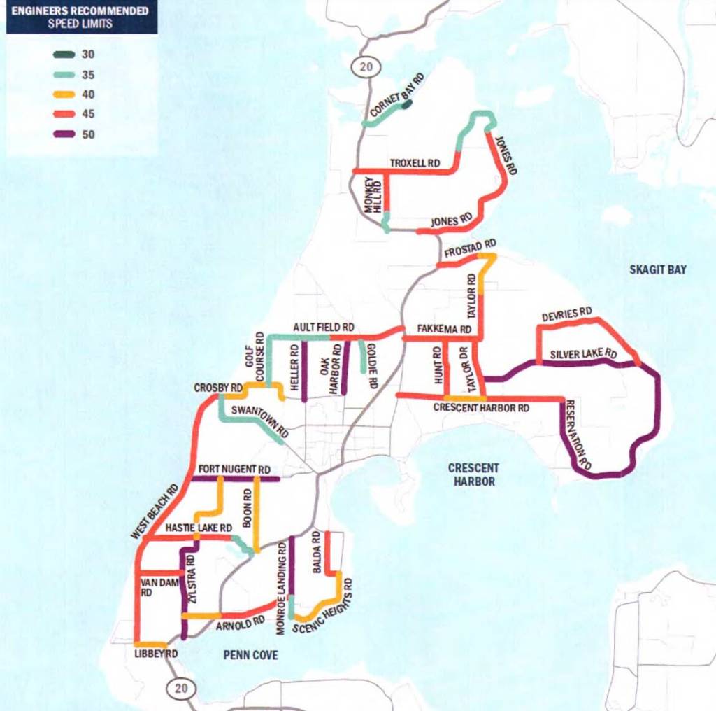
Under the recommendations, sections of several North Whidbey roads that currently have 50 mph limits would be reduced to 45 mph. That includes Jones, Troxell, Monkey Hill, Arnold and Fakkema roads. West Beach Road would be changed to a 45 mph limit for its entirety instead of the current limits, which is 40 mph north of Fort Nugent Road and 50 mph south of it.
In addition, the study recommends that the sections of Heller and Oak Harbor roads in the county would be increased from 45 to 50 mph.
According to a memorandum by Public Works Director Connie Bowers, the draft recommendations for Central Whidbey, South Whidbey and Camano Island will be discussed at separate work sessions. A consultant was contracted in 2020 to do the project.
In 2019, the county was awarded road safety funds to develop a tool to complete a county-wide speed limit study and develop a tool to automate speed limit recommendations. The purpose is to provide consistent and safe speeds along Island County roadways, Bowers wrote.
Speed limits have been somewhat contentious issues for county commissioners in the past. They’ve had to balance the requests of neighborhoods that ask for speed limit reductions with the recommendation from county engineers, who set the speeds according to standards. Ten years ago, for example, the commissioners rejected community petitions to reduce speeds on Classic and Patmore roads on the advice of county engineers.
The new draft speed limit policy establishes a process “to evaluate and suggest appropriate posted speeds with a focus on minimizing changes within corridors,” according to the memorandum. Factors that are considered include roadway context, whether the road is an aerial or collector, average daily traffic and crash history.