Biking on island has its obstacles
Published 1:30 am Tuesday, June 7, 2022


Whidbey has long been a hub for bicycle tourism. The annual Tour de Whidbey draws hundreds of cyclists every year. Bike tourists traveling from Canada to Mexico or along other circuits often pass through the island to enjoy its bucolic scenery and mountain vistas.
But recreational biking isn’t the only kind that takes place on the island; every day, Whidbey residents rely on bicycles to get to work, school and other appointments.
Whatever the reason for choosing to bike, local cyclists say Whidbey is a great place to get around on two wheels — though future investments in critical cycling infrastructure could help more islanders see biking as a viable transportation option.
Whidbey agencies are always looking for opportunities to improve the island’s bikeability, representatives from island municipalities told the News-Times, though efforts to expand and improve bicycle infrastructure have been slow-going.
One bicycle infrastructure project on Whidbey has barely gotten off the ground since its conception more than a decade ago, according to Whidbey Island Bicycle Club President Matt Plush. The Whidbey Isle Trail, more commonly known as the “Bridge to Boat” trail, is a continuous, shared-use path for non-motorized transportation that would extend from the Deception Pass Bridge to the Clinton ferry terminal, with a short branch in Central Whidbey leading to the Coupeville ferry terminal.
Currently, most of the trail exists in concept only. The idea was adopted in 2009 as an amendment to Island County’s 2006 Non-Motorized Trails Plan, but the cost of the project has been an obstacle. According to the county’s 2018 Non-Motorized Trails Plan, the shared use path costs around $2 million per mile.
Portions of a potential island-spanning trail already exist adjacent to Highway 20 in Coupeville and Freeland. Most recently, the county is working on securing funding and making a plan for a section of trail in Clinton near Ken’s Korner.
Island County is “always looking at different ways to make the island itself more bike friendly,” county Assistant Public Works Director Fred Snoderly said, though he noted that besides the upcoming Clinton portion of the Bridge to Boat trail, there aren’t any other specific biking-related initiatives going on at the county level at the moment.
Though existing and planned portions of the Bridge to Boat path provide critical trails to areas that need them, a piecemeal approach to installing bicycle infrastructure can also result in “roads to nowhere” when those pieces remain unconnected to larger networks for too long.
In Oak Harbor, for example, a two-block separated bike lane on Heller Road provides a brief spell of safety for cyclists, but does not connect to any other trails or bike lanes, city Principal Planner Cac Kamak said.
“You have one section of safe lane, and then it dumps off to somewhere that’s not safe,” he said.
Oak Harbor is in the early stages of updating its active, or non-motorized, transportation plan. Kamak said the city will soon be reaching out to consultants to complete studies and determine where the city’s bicycle and pedestrian networks could be strengthened.
“I’ve always thought that Oak Harbor is small enough that you should be able to bike everywhere,” he said.
Some plans to update the city’s bicycle network are already in the works. Kamak said that the city plans to resurface part of Whidbey Avenue in the near future and will add bike lanes to the road in the process.
Coupeville is also currently updating its active transportation plan as part of its ongoing comprehensive plan update.
“We’re looking at our current bicycle network, and we’ll be reviewing it to determine where we may need to add to it or where we might need to make connections throughout town,” town Planning Director Donna Keeler said.
Central Whidbey has the distinction of being connected by the Kettles Trail system, a network of bikeable trails threading through Ebey’s Landing National Historical Reserve. While these dirt trails are largely used for recreational mountain biking, a paved path, also commonly referred to as the Kettle Trail and part of the Bridge to Boat corridor, runs adjacent to Highway 20 through Coupeville.
In town, biking is common for both recreational and transportation purposes, Keeler said. There are a few designated bike lanes in Coupeville, and the speed limit in town is 25 miles per hour, which can help cyclists feel safer sharing the road with cars. Still, Keeler said, some children or other less-experienced cyclists opt to bike on the sidewalk to preclude potential encounters with vehicles.
Some small efforts to improve conditions for cyclists are already underway, Keeler said. The Grace Street Parklet, a pedestrian-only area with public seating planned for a short section of a downtown road, will include bike parking, something that the town generally lacks.
Across the island, cyclists, or folks who would like to be cyclists, are raising the call for more trails. On the South End, middle school Alternative Learning Experience students signed and sent a petition to Langley Mayor Scott Chaplin asking for the town to consider implementing a protected shared-use path along the school and park corridor on Maxwelton Road.
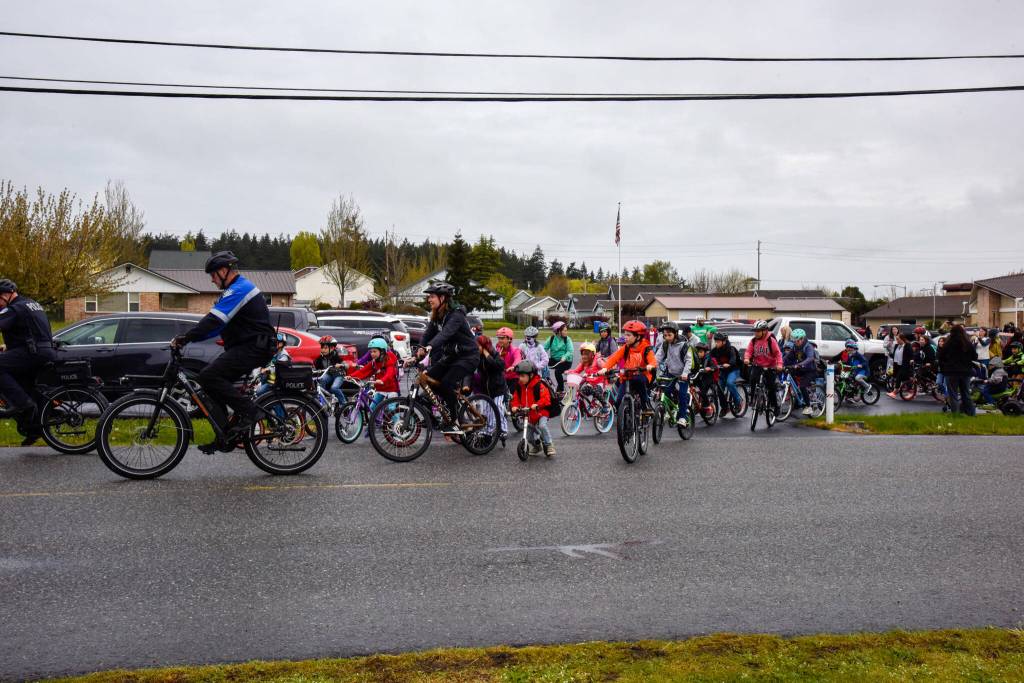
In Oak Harbor, where Broad View Elementary School students celebrated National Bike to School Day with a bike parade last month, physical education teacher Carrie Riepma said that “more designated recreational paths throughout the town, and between neighborhoods, would help promote biking as a more accessible transportation option for students.”
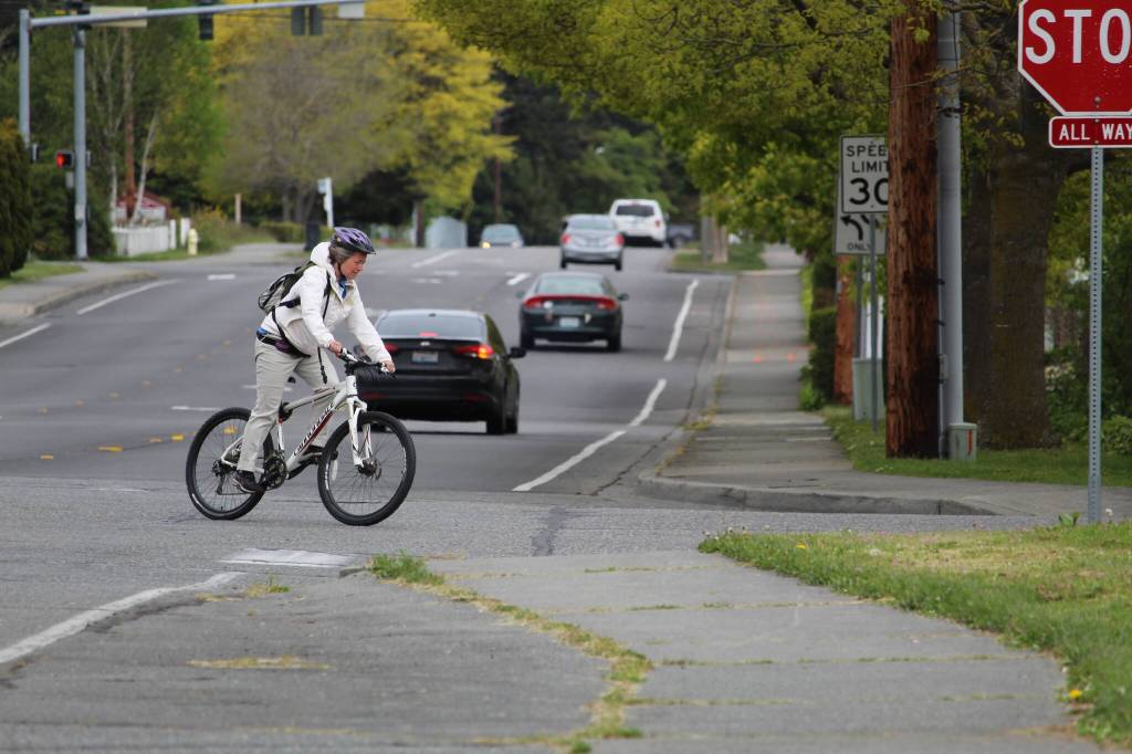
Local cyclist Laura Bergman said even as an experienced bike rider, she avoids Highway 20 as often as possible. She said concerns about cyclist safety on the highway is a deterrent to many Whidbey residents who would otherwise cycle regularly. A separate, protected trail along the highway corridor such as on the ones in Coupeville and Freeland would encourage biking among islanders.
Such a trail would be especially beneficial in areas where the highway shoulder narrows, such as near Outlying Field Coupeville and the Deception Pass Bridge, Plush said. Plush, who bikes recreationally around four times a week, said he avoids riding in those areas.
Despite some infrastructure deficiencies, however, Whidbey cyclists said they find most of the island bikeable and usually feel safe out on the road. Most island roads have wide shoulders, and Whidbey drivers tend to be aware of bike riders and give them plenty of space, several cyclists said.
One effective way to cycle around Whidbey is to combine bike-riding with transit. Island Transit mobility specialist Maribeth Crandell said that while many distances on the island might be too far for some people to bike, most people live within biking distance of a bus that could get them where they need to go.
All Island Transit buses are equipped with bike racks that can hold two or three bicycles. If the bike racks are full, bus drivers will sometimes allow cyclists to bring their bikes aboard the bus if they have room. Crandell said that on two separate occasions when both the bike rack and bus interior were full, she has seen a cyclist volunteer to take their bike off the rack and ride the rest of the way to their destination to make room for another biker who needed to board.
First-time bus riders need not be intimidated by the prospect of learning the public transit system, Crandell said.
“Our bus system is so friendly and easy to use that if anybody is ever going to start using a bus, if they’ve never used the bus before, ours is a really good system to learn on,” she said.
Island Transit buses are fare free and allow for flagged stops along their routes. Crandell added that the bus drivers are friendly and helpful to riders.
Bergman and her wife, who haven’t owned a car in years, navigate the island entirely by bike and bus. The couple lives between Greenbank and Freeland and opts to cycle for nearly all regular errands; grocery runs, school pickup, visits to the doctor and trips to the park are all done by bicycle, Bergman said. For longer trips to Coupeville or Oak Harbor, they load their bikes onto Island Transit buses.
“It’s pretty great, I have to say,” she said of her family’s car-free lifestyle.
Still, as with biking on the island, there are gaps in local transit infrastructure that can make it difficult for some Whidbey residents to consistently rely upon the buses as a primary means of transportation.
For example, not all parts of the island receive consistent bus service. There is no bus that runs through the Strawberry Point area on the northeastern part of the island; Oak Harbor’s east city route only extends as far east as Taylor Road. On the South End, the Scatchet Head area only receives bus service during commuter hours, leaving residents without easy transit access for most of the day.
Roads on these parts of the island also don’t have as wide shoulders as other Whidbey roads, which might deter some cyclists from biking to the bus route.
Island Transit buses also do not operate on Sundays or in the evenings, though that may soon change; the agency has been investigating options for expanding its services, and evening and Sunday service were among the top requests from Island Transit riders.
The benefits of cycling are myriad, Bergman said; replacing even short car trips with bike rides saves money on gas and vehicle maintenance, facilitates physical exercise, reduces carbon emissions and helps alleviate car traffic.