Hoping to learn more about the ginormous landslide that rocked Ledgewood last month, geology experts spent much of this week drilling a 280-foot deep hole atop the bluff.
Under the direction of GeoEngineers, a Seattle-based firm hired by Island County, a drilling team dug a hole so deep that it went below sea level. It was drilled in the county’s right-of-way along Fircrest Avenue.
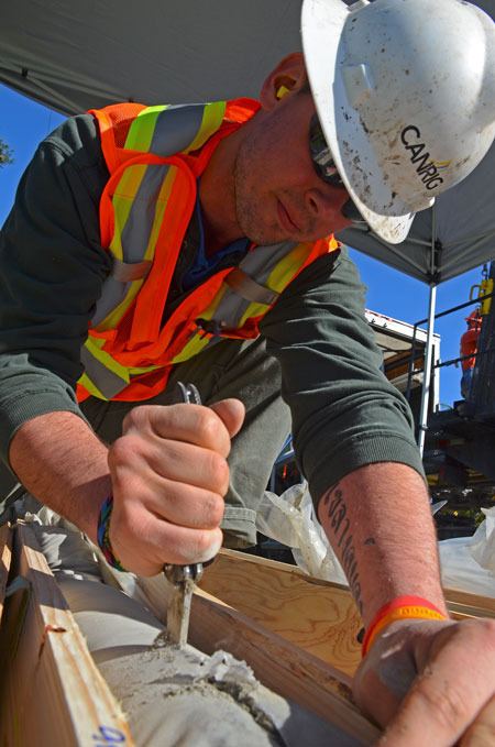
Taking regular samples along the way, the idea is to find out a little more about what caused the slide, when it will happen again and determine the overall stability and safety of the area.
“No smoking guns yet,” Aaron Hartvigsen, a geotechnical engineer with the company, said Wednesday
Soil samples up to that point — about 186 feet — revealed “typical glacial geology” common on Whidbey Island, he said.
The team had not yet run into enough loose and wet soil to cause alarm.
Landslides are often the result of water saturated soils, which provide just enough instability for a segment to slough away. Most occur on the surface, but this was a “deep seated, rotational landslide,” explained Terry Swanson, a geologist with the University of Washington.
“This is much deeper and complex.”
Swanson was on site with a student, Devin Bedard, who is working on his master’s degree.
Bedard was focusing his studies at Double Bluff when the Ledgewood slide occurred.
One of the largest known slides in Puget Sound, the Ledgewood site will now make up a large part of his research. Samples taken this week, along with later analysis, will not only help scientists better understand what triggered the event, but also help better predict or understand other landslide-prone areas, he said.
Pete Seybert, a civil engineer with Island County Public Works, said the hole will be capped and maintained. It will contain sensory equipment that will provide data on water levels and pressure.
Information will be accessible to GeoEngineers and Public Works, allowing experts to know what’s happening hundreds of feet below the surface.
Bill Oakes, director of Public Works, said the work is specialized and expensive. He expects the tab for geologic work to hit $100,000.
“Just the hole itself is going to cost between $15,000 and $20,000.”
To date, Public Works total hard costs for the Ledgewood landslide are approximately $100,000. Soft costs — labor and overtime expenses, for example — are also nearing $100,000, he said.
It’s also becoming more and more certain that the county will not be receiving financial assistance from the federal government.
State officials also notified Island County leaders that an emergency declaration will not be filed.
Other financial assistance may yet present itself, but Oakes said he isn’t optimistic.
“I’m not hopeful we’ll get help from the feds.”